
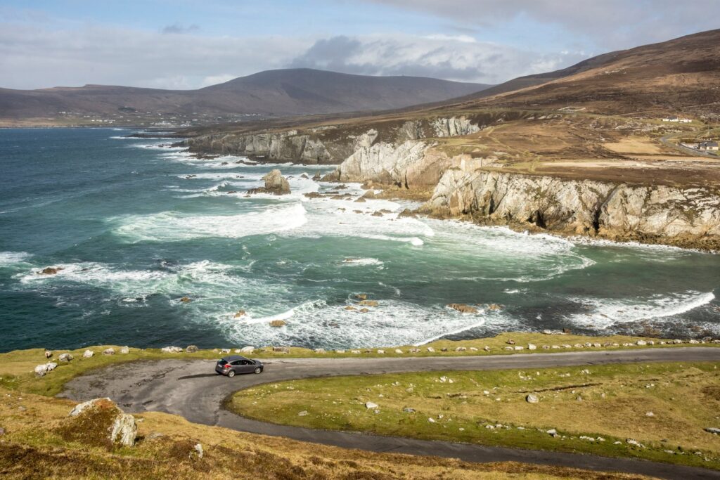
The Wild Atlantic Way is the longest defined coastal touring route in the world, running 1,600 miles from Kinsale in County Cork north to Malin Head in County Donegal. It traces Ireland‘s entire western seaboard through nine counties, connecting clifftop drives, fishing villages, islands, and some of the country’s most dramatic landscapes.
You won’t drive it all in one trip—most visitors tackle a section or two. Here’s how to approach this coastal marathon, what to prioritize, and how to make the most of your time on Ireland’s wildest edge.
Breaking Down the Route Into Sections
The Wild Atlantic Way is divided into five official sections, each with its own character. From south to north: the Haven Coast (Cork), the Surf Coast (Cork and Kerry), the Cliffs and Headlands (Clare and Galway), the Bay Coast (Galway and Mayo), and the Surf and Turf Coast (Sligo and Donegal).
Most first-timers focus on one or two sections. The Cliffs and Headlands section—running from Loop Head in Clare through the Burren, Connemara, and up to Achill Island in Mayo—is the most popular. It includes the Cliffs of Moher, the limestone pavements of the Burren, and Connemara’s mountains and bogs.
If you’re short on time, a seven-day trip covering Galway, Clare, and Kerry hits the highlights: Galway city, the Cliffs of Moher, Doolin, the Burren, Dingle Peninsula, and the Ring of Kerry. A ten-day trip adds Connemara and Westport. Two weeks lets you push north into Sligo and Donegal or south into Cork.
Don’t try to rush it. The Wild Atlantic Way isn’t a highway—it’s a network of narrow, winding coastal roads where 30 miles can take an hour. Build in time to stop, walk, and explore.
What You’ll See Along the Way
Each section offers something different. In County Clare, the Cliffs of Moher tower 700 feet above the Atlantic, and the Burren’s karst landscape feels like another planet. County Galway brings Connemara’s wild beauty—mountains, lakes, bogs, and the Sky Road loop outside Clifden.
In Kerry, the Dingle Peninsula offers ancient stone forts, mountain passes, and fishing villages like Dingle town. The Ring of Kerry loops around the Iveragh Peninsula with views of Skellig Michael offshore. Further north, County Mayo’s coastline includes Achill Island, Ireland’s largest island, connected by bridge and ringed with beaches and cliffs.
Donegal, at the northern end, is the least visited and most dramatic. Slieve League’s sea cliffs rise nearly 2,000 feet—three times the height of the Cliffs of Moher. Malin Head, Ireland’s northernmost point, feels like the end of the world.
Along the entire route, brown signs marked with a white wave symbol guide you to viewpoints, beaches, and heritage sites. Follow them—they lead to the best stops.
Practicalities: Car Hire, Driving, and Timing
You’ll need a car. Public transport doesn’t serve most of the coastal villages and viewpoints. Rent from Shannon or Cork if you’re starting in the south, or from Knock or Galway if you’re focusing on the middle sections. Belfast or Dublin work if you’re beginning in Donegal.
The roads are narrow, often single-lane with passing places. You’ll drive on the left. Take it slow, especially in rain or fog. Expect sheep on the roads in rural areas—they have right of way.
May through September offers the best weather and longest daylight, but also the biggest crowds at major sites like the Cliffs of Moher. April and October are quieter, with decent weather. Winter (November through March) brings short days, frequent rain, and some attractions on reduced hours, but you’ll have the roads largely to yourself.
Accommodation books up in summer, especially in popular towns like Dingle, Doolin, and Westport. Reserve ahead. Consider staying in smaller villages between the big stops—places like Ballyvaughan in Clare, Leenane in Connemara, or Ardara in Donegal offer good bases without the crowds.
Insider Tips for the Drive
Start early each day. The best light for photography is in the morning, and you’ll beat the tour buses to major sites. Pack layers—coastal weather changes fast, and wind is constant even in summer.
Don’t skip the small detours. Some of the best views aren’t at the marked Discovery Points but on unnamed bogs roads and coastal lanes. If you see a turnoff to a beach or headland, take it.
Build in rest days. After several days of driving, stop for a night or two in a town like Galway, Dingle, or Westport where you can walk, eat well, and hear traditional music without getting back in the car.
Fuel up often—petrol stations are scarce in remote areas, especially in Connemara and Donegal. Fill your tank when you see one.
If you’re visiting major attractions, Viator offers skip-the-line tickets and guided day trips from Galway and other hubs that take the stress out of navigating to the most popular sites.
The Wild Atlantic Way isn’t a checklist—it’s a journey meant to be savored. Give yourself time to stop, breathe the salt air, and watch the light change over the Atlantic. That’s when Ireland’s west coast reveals itself.
Want more stories like this delivered daily? Subscribe to The Ultimate Ireland Travel Guide newsletter—one short story a day, straight to your inbox.
Heads up — some links in this article are affiliate links. If you sign up through them, we may earn a small commission at no extra cost to you. We only recommend tools we use ourselves.