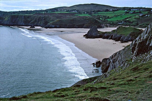
The Dingle Peninsula in County Kerry doesn’t get the same international fanfare as the Ring of Kerry, but travelers who’ve driven both will tell you: Dingle wins. The roads are narrower, the crowds thinner, and the scenery—wild Atlantic cliffs, stone-walled fields tumbling into the sea, and mountains that seem to rise straight out of the water—feels more intimate and untouched.
The main loop is the Slea Head Drive (Slí Cheann Sléibhe), a 30-mile circuit that starts and ends in Dingle town. You can drive it in two hours if you’re rushing. Give it a full day if you want to actually see it.
The Slea Head Drive: What You’ll See
Head west out of Dingle on the R559 toward Ventry. The road hugs the coast almost immediately, passing Ventry Beach—a wide, sandy stretch popular with surfers and families. On a clear day, the views across Dingle Bay to the Iveragh Peninsula are spectacular.
Continue west and you’ll reach Slea Head itself, the westernmost point of the peninsula. The cliffs here drop straight into the Atlantic, and on the horizon you’ll see the jagged silhouettes of the Blasket Islands. There’s a small parking area where you can pull over and take it in.
Just past Slea Head, look for signs to the Dunbeg Fort, an Iron Age promontory fort perched on a cliff edge. Admission is around $5, and the site includes several reconstructed clochán—stone beehive huts that date back over a thousand years. They’re small, dark, and surprisingly intact.
Further along the loop, you’ll pass through the village of Dunquin, where the Blasket Centre offers exhibits on the now-abandoned Blasket Islands and the Irish-language writers who once lived there. The café has good coffee and views that make it hard to leave.
Detours Worth Taking
If you have time, take the Connor Pass (R560) on your way back toward Tralee or onward to the north side of the peninsula. It’s the highest mountain pass in Ireland, and the drive—especially the climb from the Dingle side—is breathtaking. The road is narrow and steep, with hairpin turns and sheer drops, so it’s not for nervous drivers or large vehicles. At the summit, there’s a small parking area and walking trails that lead to hidden lakes and ridgeline views.
On the north side of the peninsula, the village of Cloghane sits at the foot of Mount Brandon, Ireland’s second-highest peak. It’s quieter than Dingle town, with a couple of traditional pubs and access to some excellent coastal and mountain walks.
Practical Tips for Driving the Loop
Drive clockwise, starting west from Dingle. The route is better appreciated in this direction, and you’ll be on the inside lane for most of the coastal views, making it easier to pull over safely.
The roads are narrow—often single-track with passing places. Take your time, especially if you’re still getting used to driving on the left. Locals know the roads well and will often flash their lights or wave to indicate they’re letting you pass.
Fuel up in Dingle before you leave. There are no gas stations once you’re out on the loop, and mobile reception can be patchy in places.
The best light for photos is late afternoon, when the sun is low over the Atlantic and the cliffs glow gold. Early morning is quieter if you want the roads and viewpoints mostly to yourself.
If you’re planning to visit the Blasket Centre or Dunbeg Fort, bring cash or check ahead—some smaller sites still don’t take cards reliably.
When to Go
Summer (June through August) brings the longest days and the warmest weather, but also the most visitors. September is ideal: still mild, with clearer skies and fewer tour buses. Spring (April and May) can be spectacular if you catch a good weather window, with wildflowers blooming along the roadsides.
Winter is atmospheric but unpredictable. Storms roll in fast off the Atlantic, and some roads can close temporarily in high winds. If you’re driving the Connor Pass in winter, check conditions before you go.
No matter when you visit, pack layers. The weather on the peninsula can change in minutes, and even on a sunny day, the wind off the sea is cold.
Want one story a week about Ireland’s hidden corners, best drives, and places worth your time? Subscribe to The Ultimate Ireland Travel Guide newsletter—no fluff, just the good stuff.