
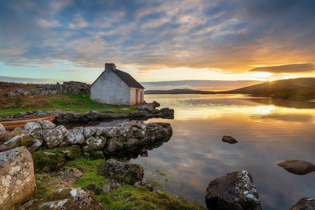
Connemara occupies the western edge of County Galway, a region of blanket bog, quartzite mountains, and an indented coastline where the Atlantic crashes into rocky coves. It’s a place of sparse population, Irish-speaking villages, and landscapes that shift from heather and gorse to limestone shoreline in the space of a single drive. You won’t find manicured trails or visitor centers at every turn—Connemara rewards those who take the unmarked side roads and stop where the land opens up.
Most visitors pass through on a day trip from Galway City, but the region deserves at least two nights and the freedom to wander without a fixed itinerary.
The Core Villages: Clifden, Roundstone, and Letterfrack
Clifden is Connemara’s de facto capital, a market town at the head of Clifden Bay with enough pubs, restaurants, and guesthouses to serve as a comfortable base. The town sits where the N59 meets the Sky Road, a narrow loop that climbs west above the bay and offers views across to the Twelve Bens mountain range. Drive it in late afternoon when the light is low and the stone walls glow gold.
Roundstone, 24 kilometers south on the R341, is smaller and quieter, a fishing village built around a natural harbor. Stop at O’Dowd’s for seafood and a pint, then walk the shoreline out toward Dog’s Bay and Gurteen Beach—two white-sand crescents made of crushed shells, not rock. The water is cold year-round, but the beaches are empty even in summer.
Letterfrack, northwest of Clifden on the N59, is the gateway to Connemara National Park and a handful of craft shops and cafés. The village itself is tiny, but it’s well-positioned for exploring the Twelve Bens and the coast around Tully Cross.
The Drives: Sky Road, Inagh Valley, and the Coast
The Sky Road is the most famous loop, but the Inagh Valley Road—the R344 between Recess and Kylemore—is the more dramatic drive. The narrow road follows a glacial valley flanked by the Maumturk Mountains to the east and the Twelve Bens to the west, with bogland stretching out in both directions. There are no villages, just a handful of farmhouses and the occasional stone bridge. Pull over at one of the unmarked tracks and walk into the silence.
The coastal route along the R340 and R341 from Spiddal to Roundstone threads through Irish-speaking villages—Carraroe, Carna, Cashel—where road signs are in Irish first. The road hugs the shoreline, twisting past turf stacks, whitewashed cottages, and stone piers. It’s slower than the inland N59, but it’s the heart of the Gaeltacht, where Irish is still the daily language.
For a quieter alternative, take the Renvyle Peninsula loop west of Letterfrack. The road dead-ends at Renvyle Point, where you can park and walk out to the ruins of an old castle on the rocks. On clear days, you’ll see Clare Island and the cliffs of Achill to the north.
Lakes, Bogs, and the Twelve Bens
Connemara National Park, just south of Letterfrack, covers 2,957 hectares of bog, heath, and mountain. The park’s marked trails range from easy boardwalks through the bog to steep climbs up Diamond Hill, which rewards a two-hour round trip with views over Kylemore, Ballynakill Harbour, and the Twelve Bens. The visitor center explains the ecology of blanket bog and the reintroduction of Connemara ponies to the park.
The Twelve Bens themselves—a compact range of quartzite peaks—are for experienced hillwalkers. The most popular ascent is Benbaun, the highest at 729 meters, accessed from the south via Glencoaghan. Bring waterproofs, a map, and expect cloud even when the forecast is clear.
Lough Inagh, Derryclare Lough, and Ballynahinch Lake are the region’s largest lakes, all easily seen from the road. There are no facilities—just pull-offs where you can park and fish for wild brown trout if you have a license.
Practical Details: Getting Around and Where to Stay
Connemara has no train service and limited bus routes. Hire a car in Galway City—it’s 80 kilometers west to Clifden on the N59, about 90 minutes without stops. Drive on the left, expect narrow roads, and give way to sheep.
Clifden has the widest range of accommodation, from budget B&Bs to boutique hotels. Roundstone and Letterfrack offer smaller guesthouses and a handful of self-catering cottages. Book ahead between May and September; outside those months, many places close or reduce hours.
Petrol stations are sparse—fill up in Clifden, Recess, or Letterfrack before heading out on the smaller loops. Mobile signal is patchy once you leave the N59.
The best months to visit are May, June, and September, when daylight is long and the heather is in bloom. July and August bring more visitors and higher prices. October through April can be beautiful but expect rain, wind, and many businesses closed for the season.
There’s more to Connemara than one drive-through afternoon reveals. Subscribe to The Ultimate Ireland Travel Guide newsletter and get one short story a day—regions, villages, and roads worth the detour.