
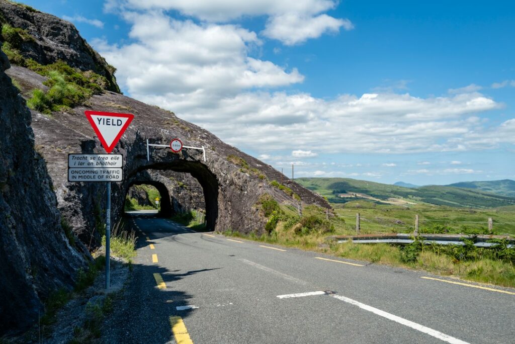
The Dingle Peninsula in County Kerry delivers everything Ireland promises: jagged cliffs plunging into the Atlantic, ancient stone forts perched on headlands, and villages where Irish is still the first language. The main loop, Slea Head Drive, runs roughly 30 miles from Dingle town and back, but you’ll want a full day to do it justice.
This is one of the country’s most rewarding drives, and it’s blissfully quieter than the Ring of Kerry. The roads are narrow, the scenery is relentless, and the stops are worth every minute.
The Route: Slea Head Drive
Slea Head Drive (also signposted as Slí Chinn Sléibhe) forms a roughly circular route starting and ending in Dingle town. Most drivers take it counterclockwise, heading west out of town on the R559 toward Ventry, then looping around the tip of the peninsula and returning via Dunquin and Ballyferriter.
The entire loop is about 30 miles, but plan on four to six hours with stops. The roads are single-track in places with passing points, and you’ll be pulling over constantly for views, sheep, and the occasional tractor.
Start with a full tank in Dingle town. There are no petrol stations once you leave, and services are sparse until you loop back.
Where to Stop Along the Way
Just west of Dingle, Ventry Beach is a wide crescent of sand backed by green hills. It’s a good early stop to stretch your legs and get a sense of the coastline ahead.
Further along, the road climbs above the ocean, and the views open up toward the Blasket Islands. Pull over at the designated viewpoints—there are several—and take in the offshore silhouettes. On clear days, you’ll see Great Blasket, the largest and most famous of the group, abandoned in 1953 but immortalized in Irish literature.
Dunbeg Fort (also called Dún Beag) is a stone promontory fort clinging to a cliff edge. It’s Iron Age, roughly 2,500 years old, and remarkably intact. There’s a small admission fee (around $4), and the views alone justify it. The fort sits on a narrow spit of land with the ocean on three sides.
At Slea Head itself, the road hugs the cliffs, and the Blaskets dominate the horizon. This is the westernmost point of the drive and one of the most photographed stretches of road in Ireland. There’s a small car park at the viewpoint.
In Dunquin, stop at the Blasket Centre (Ionad an Bhlascaoid Mhóir), a heritage center dedicated to the history and literature of the Blasket Islands. The building itself is striking—modern, glass-fronted, perched on a hillside—and the exhibits tell the story of the island community through photographs, recordings, and artifacts. Admission is around $6.
On the return leg, Gallarus Oratory is a must. This tiny, perfectly preserved stone chapel dates to the early medieval period, built without mortar in the shape of an upturned boat. It’s stood for over a thousand years and still doesn’t leak. There’s a small car park and visitor center; entry to the oratory itself is free, though the center charges a modest fee.
Practical Tips for Driving the Loop
Drive counterclockwise. You’ll be on the inside lane for most of the coastal stretches, making it easier to pull over and safer for passengers to hop out at viewpoints.
Leave Dingle town by mid-morning to avoid tour buses, which tend to start the loop around 10 or 11 a.m. If you’re on the road by 9 a.m., you’ll have the best light and fewer vehicles ahead of you.
Bring layers. The peninsula is exposed to Atlantic winds, and the weather can shift fast. Even in summer, a waterproof jacket is essential.
Pack a lunch or snacks. There are a few cafés in Dunquin and Ballyferriter, but options are limited, and you might not want to break the rhythm of the drive. A picnic at Coumeenoole Beach or Slea Head is hard to beat.
Take your time. This isn’t a route to rush. The real pleasure is in the stopping, the walking down to a beach, the scrambling up to a viewpoint, the sitting in silence with the ocean below.
When to Go
May through September offers the longest days and the best odds of clear weather, but the peninsula is beautiful year-round. October brings dramatic skies and fewer crowds. Winter can be wild—high winds, heavy rain—but if you catch a clear day, the light is extraordinary.
Avoid July and August weekends if you want solitude. Midweek in shoulder season is ideal.
If you’re planning other stops along the way, Viator offers guided tours that bundle Slea Head with visits to Gallarus and the Blasket Centre, though renting a car and going at your own pace gives you far more flexibility.
The Dingle Peninsula rewards slow travel. Drive it once, and you’ll understand why so many visitors come back.
Want more Ireland stories like this delivered daily? Subscribe to The Ultimate Ireland Travel Guide newsletter—one short story a day, straight to your inbox.
Heads up — some links in this article are affiliate links. If you sign up through them, we may earn a small commission at no extra cost to you. We only recommend tools we use ourselves.